High resolution air quality modelling
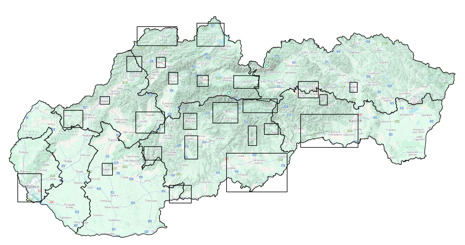
High resolution modeling was performed by combining the CALPUFF and ATMOSTREET models for the entire year 2021.. Since this modeling is computationally demanding and currently it is not possible to cover the entire territory of Slovakia with a computational domain, areas were selected in individual regions based on the spatial distribution of municipalities with a relatively high number of houses with solid fuel heating (Fig. 1). The CALPUFF model was used for modeling local heating and NEIS sources, the ATMOSTREET model, which also takes into account limited dispersion in street canyons, calculated the contribution of road transport. Background values were used from the RIO model (for PM10, PM2.5 and NO2). For benzo[a]pyrene, concentrations measured on the EMEP Stará Lesná regional station were used as background. The exception was Bratislava. Meteorological inputs for CALPUFF were prepared using the CALMET diagnostic model, which processed data from the ALADIN model to the higher spatial resolution (250 x 250 m) required for CALPUFF.
Detailed modeling results for individual domains in the form of maps and graphs can be viewed by clicking on the links below, broken down by individual regions.
| Bratislavský kraj | Trenčiansky kraj |
| Banskobystrický kraj | Žilinský kraj |
| Trnavský kraj | Prešovský kraj |
| Nitriansky kraj | Košický kraj |
Note: based on the Method of Integrated Assessment of Municipalities with regard to the risk of adverse air quality, there are no risky municipalities in the Trnava region (risk level 3). Therefore, high-resolution air quality modeling have not yet been performed in the Trnava region. The input data was used for the year 2021.